Colorado & Green Rivers in the Canyonlands 3rd Edition Guide Book
Available in store
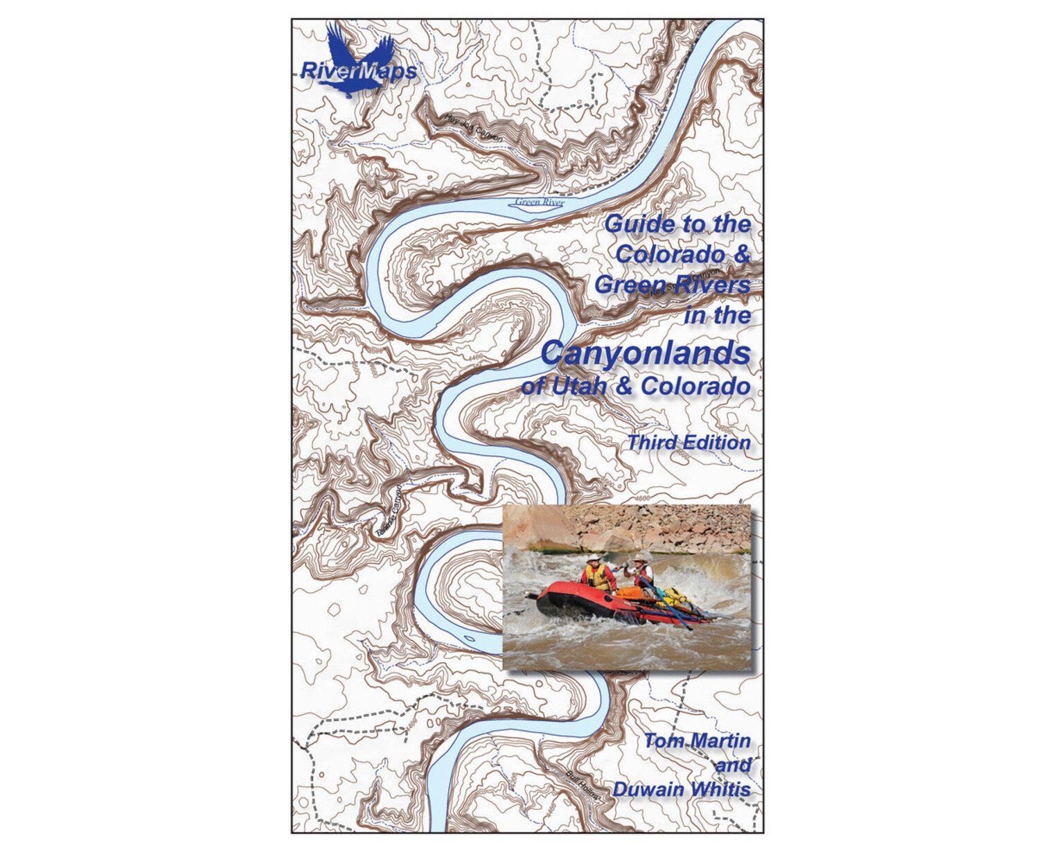
CloseThe Guide to the Colorado & Green Rivers in the Canyonlands is a must-have guidebook for your trip into the Canyonlands of Utah and Colorado. Durable and waterproof, with USGS maps and excellent descriptions of river features.
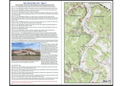
- This book covers the entire permitted portions of Labyrinth and Stillwater Canyons on the Green River, and on the Colorado River through Horsethief, Ruby, Westwater, the Moab Daily, Meander, Cataract and Narrow canyons.
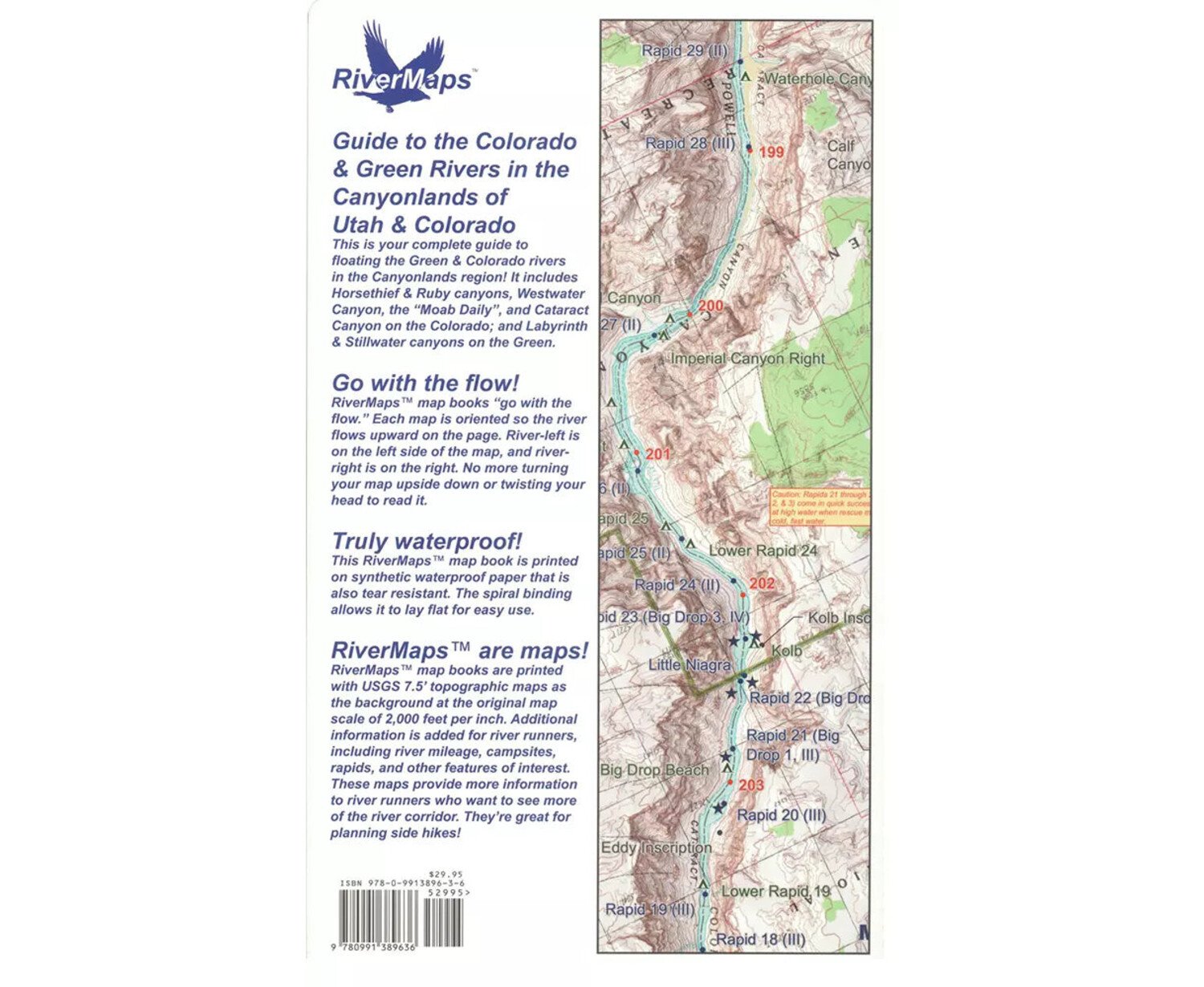
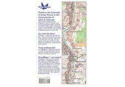
- Spiral bound format with full color topo maps on right side and complete text descriptions on the facing page.
- Color photos highlight some of the river's more famous attractions and features.
- Excellent mile by mile information on rapids, campgrounds, geological features, historical sites and reference points.
- The topo maps are the same scale as the original USGS maps. The contour lines and accurate shape of the river really help you keep track of where you are.
- High quality waterproof, tear-resistant paper handles the splash and abuse of negotiating rivers.
- This guidebook also includes numerous side hikes and interesting features away from the river.
- Includes info pages on frequently asked questions about boating the river, area geology, archaeology, resources protection and plants found along the river, as well as emergency contact information.
Errata & Revisions
Effective July 1, 2020, Colorado Parks and Wildlife will require all persons 18 and older to possess a proper and valid Colorado hunting or fishing license to access the Loma Boat Launch State Wildlife Area. One-day licenses are available from authorized vendors. If you wish to avoid the extra cost and hassle, alternative upstream launch points include:
- James M. Robb Colorado River State Park at Fruita. This State Park is just west of State Route 340. Located about 4 miles upstream of the Loma Ramp. There is a fee to get into the state park.
- Just a half mile further upriver on the northeast side of the State Route 340 bridge is a small public access dirt ramp to the river. This is a fee-free ramp.
- Right across the river from the dirt ramp is Rimrock Adventures, also about 4.5 miles from the Loma Ramp. You will need to use their services to access their ramp. They provide shuttle services for a fee of course.
- Blue Heron Boat Launch located off of Redlands Parkway in Grand Junction. About 10 miles upstream of the Loma Ramp. Managed by Colorado Parks and Wildlife, this is a free ramp and is not a state wildlife area. It is not a huge ramp and is very popular for people doing the town float so be patient
Our Guide Books
Our spiral-bound guide books are offset-printed on plastic pages. The covers are plastic card stock. The entire books are waterproof and tear resistant (but not indestructible!). Our guide books include mile-by-mile descriptions of campsites, rapids, and points of interest and include many photographs.
Care of Your Books
You can write on dry plastic pages with an indelible marker like a Sanford Sharpie. If your offset printed map or guide book gets wet, don't worry! It can stay wet without damage. You will eventually want to dry it out with a rag or by turning and air drying each page. The pages usually won't stick, but... Don't cook your books! We have seen some books with pages that stick, especially where the ink is heavy over photographs. The only way we are able to reproduce this effect is to let a wet book dry for an extended time in the hot sun. You should avoid leaving your book in the direct sun or a hot vehicle or trailer for any longer than necessary. Day-to-day use in the sun while on the river has never been a problem that we've seen. Don't freeze your books! We have seen books that were wet and frozen lose some of their ink and underlying coating that holds the ink to the plastic page. If your book is wet and frozen, we suggest either letting it defrost or dipping it in the river for a minute to melt the ice and allow the pages to separate.
Authors: Tom Martin & Duwain Whitis
Third Edition; 110 pages with 45 maps, a total of 320 river miles, color photographs, and shaded topographic relief.
Copyright: 2016
Size: 9" x 14"