
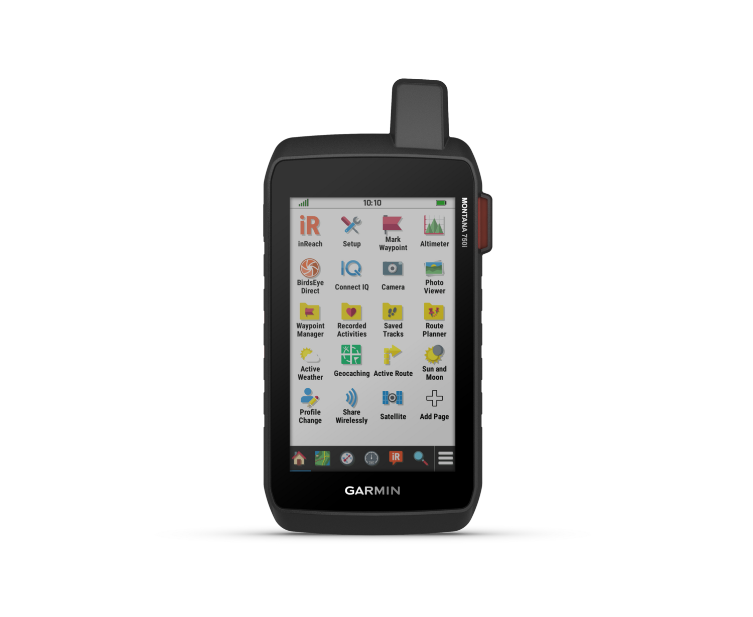


Garmin Montana® 750i
Available in store
Close
GO INTO THE WILD WITH A SATELLITE CONNECTION |
|||||
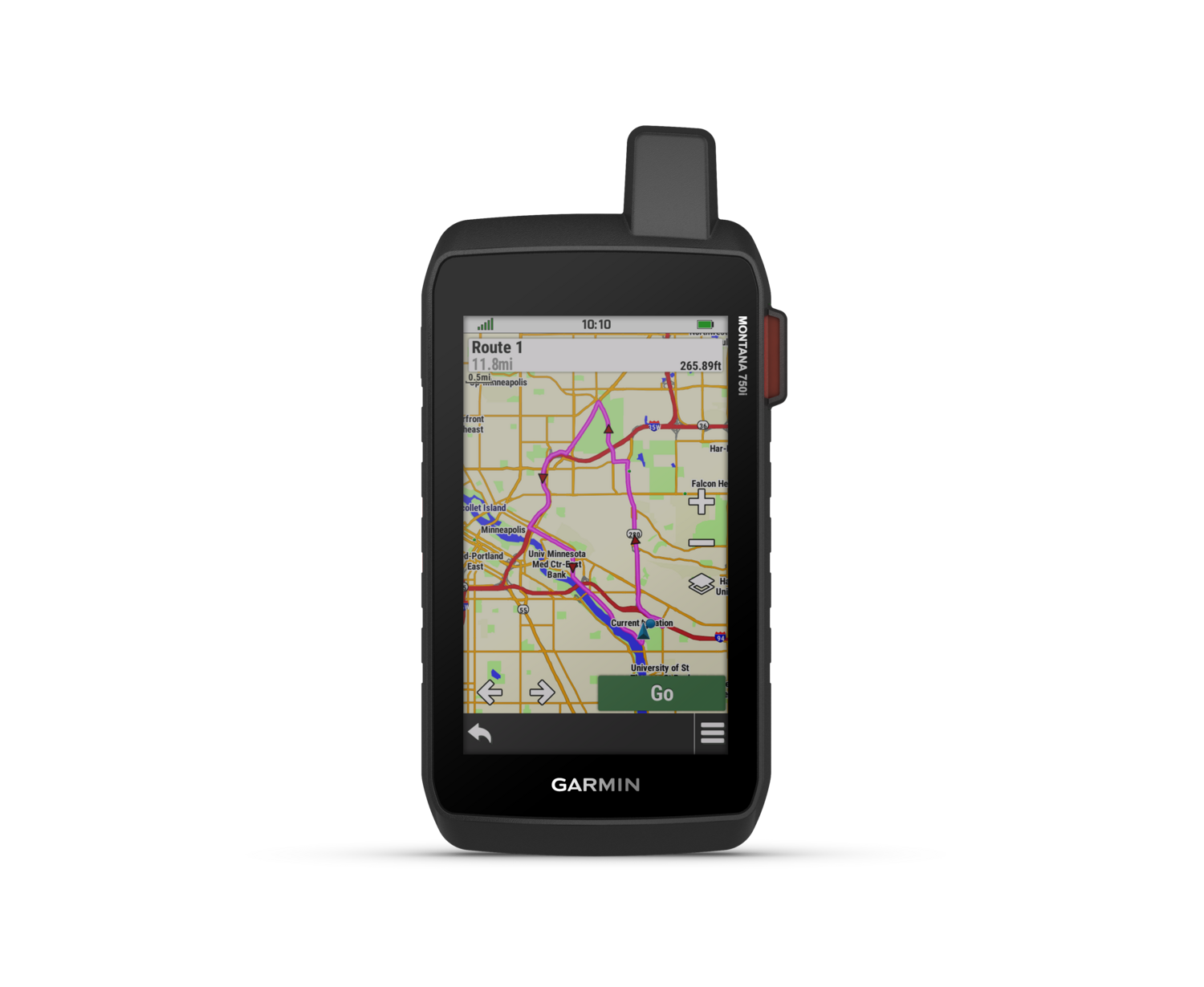
| To keep adventurers in touch and on track, the Montana 700i handheld combines the flexibility of on- or off-road navigation with global messaging and interactive SOS via inReach satellite technology | |||||
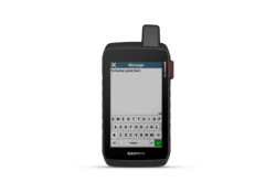
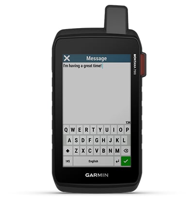
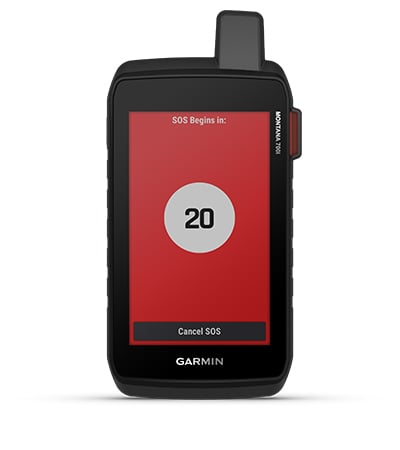
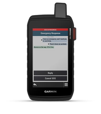
| Big news. A full QWERTY keyboard lets you easily type messages | Wander wider and still stay in touch — with inReach for messaging and 24/7 SOS. | Routable topographic maps? Check. Now you’re free to take it off-road or on. | Built like a tank. Meets MIL-STD 810 for thermal, shock, water and vibration. | Nav, meet cam. Put your trip pics on the map with geotags. | Power your adventures with 18+ hours of lithium-ion battery life in GPS mode. |
Power your adventures with 18+ hours of lithium-ion battery life in GPS mode.

Link up from way out — with inReach technology.
 |
 |
 |
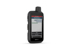
TWO-WAY MESSAGINGExchange text messages with loved ones, post to social media, or communicate via inReach device to inReach device in the field (active satellite subscription required). |
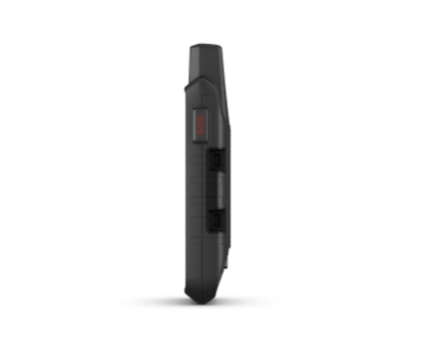
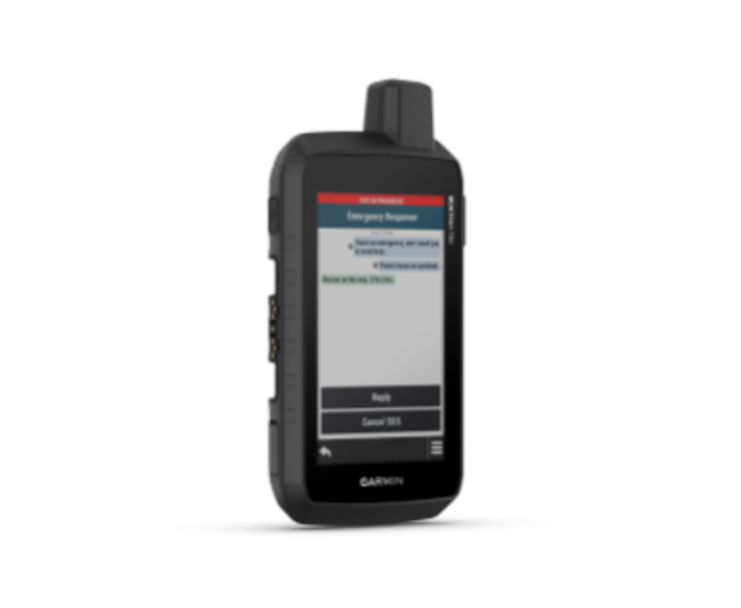
INTERACTIVE SOSIn case of emergency, trigger an interactive SOS message to GEOS, the Garmin-powered International Emergency Response Coordination Center (IERCC) with professional 24/7 global monitoring and response center (active satellite subscription required). |
GLOBAL CONNECTIVITYInstead of relying on cellphone coverage, now your messages, SOS and tracking are transferred via the 100% global Iridium® satellite network (active satellite subscription required). |
 |
||
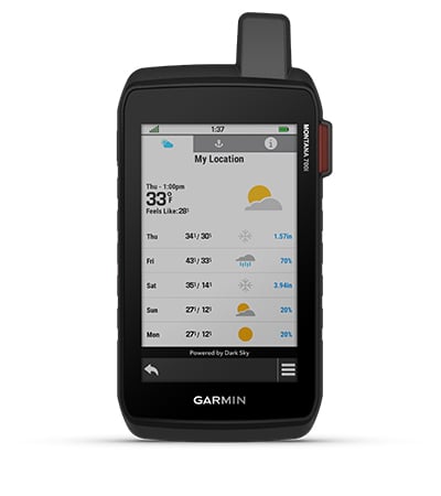
INREACH WEATHERAvailable inReach weather forecast service provides detailed updates directly to your Montana handheld or paired devices, so you’ll know what to expect en route.
|
|
|
Be prepared. With navigation for any situation.

 |
 |
 |
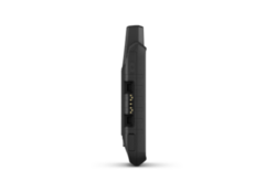
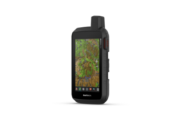
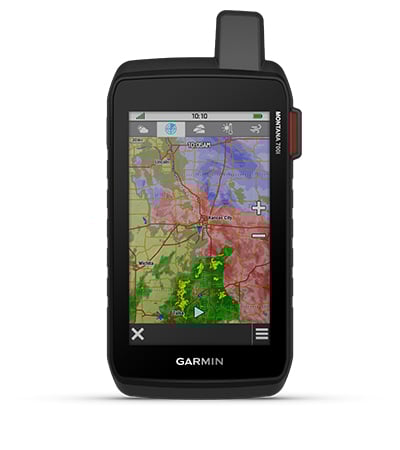
RUGGED BY DESIGNThis durable, water-resistant handheld is tested to U.S. military standards and features a glove-friendly 5” touchscreen that’s 50% larger than previous Montana models. |
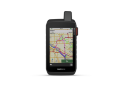
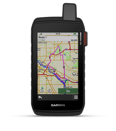
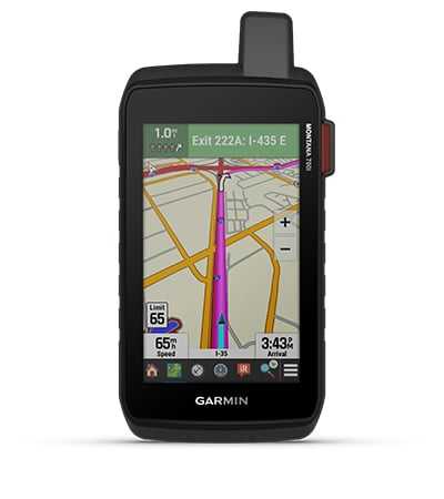
CITY NAVIGATOR MAPS®Seamlessly transition from trails to road navigation with preloaded City Navigator street mapping, which guides your drive with easy-to-follow turn-by-turn directions. |
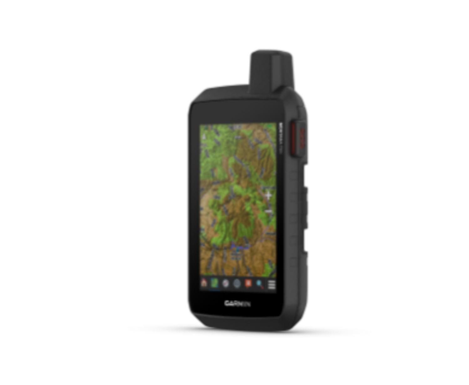
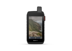
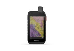
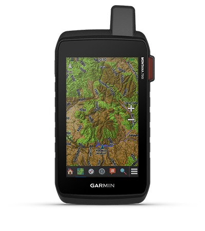
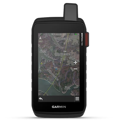
TOPOACTIVE MAPSTo navigate your adventures, use preloaded topographical maps for the U.S. and Canada. View terrain contours, elevations, coastlines, rivers, landmarks and more. |
 |
 |
 |
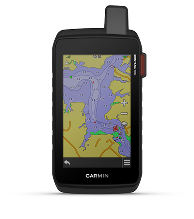
ADDITIONAL MAPSWith 16 GB of onboard memory and a microSD™ card slot for expandable storage, you can download even more maps such as BlueChart® g3 for the water. |
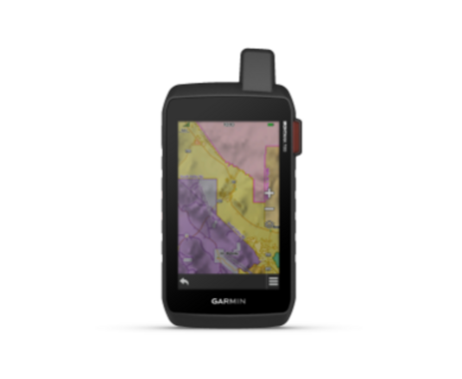
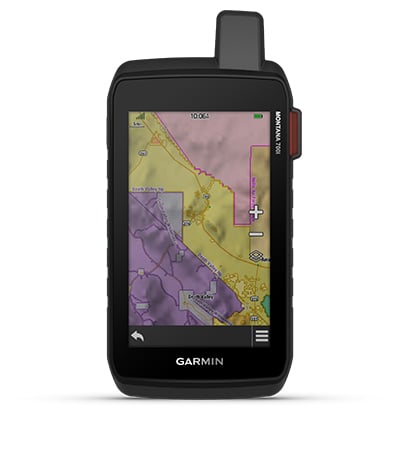
PUBLIC LAND BOUNDARIESOptional display of federal public land boundaries on topographical maps helps you know that you’re venturing where you’re supposed to be. |
SATELLITE VIEWSUse direct-to-device downloads of BirdsEye Satellite Imagery (no annual subscription required) to see photo-realistic views and create waypoints based on landmarks. |
 |
 |
|
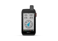
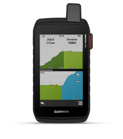
ABC SENSORSNavigate your next trail with ABC sensors, including an altimeter for elevation data, barometer to monitor weather and 3-axis electronic compass. |
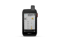
ACTIVE WEATHERUse cellular connectivity2 to access up-to-date Active Weather forecasts through the Garmin Connect™ app. |
DOG TRACKINGFor hunters and trainers, this Montana syncs with compatible Astro® or Alpha® series handhelds (sold separately) to help track sporting dogs in the field. |
 |
 |
|
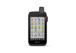
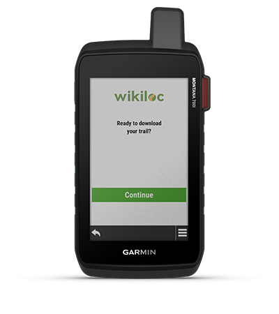
WIKILOC TRAILSThis preloaded app lets you easily download hiking, cycling and other Wikiloc trails shared by outdoor enthusiasts like you. Get a free 60-day Wikiloc Premium trial to try this and other exclusive features. Learn more. |
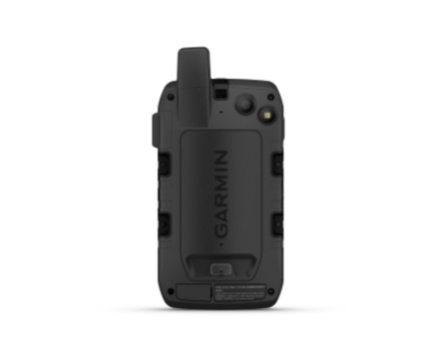
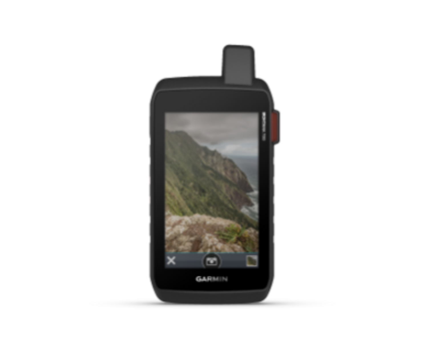
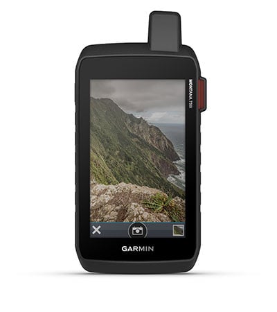
BUILT-IN CAMERACapture images of your exploits with Montana’s digital 8-megapixel camera. It geotags photos with coordinates, so you can navigate back to favorite sites in the future. |

Stay on track while venturing off-grid.
MULTI-GNSS SUPPORT
Access to both GPS and Galileo satellite networks enables Montana 700i to track in more challenging environments than GPS alone.
TRACKING
Using your web-based MapShare™ trip-sharing page, followers can see your progress, ping your device to see your GPS location and exchange messages during your trip.
EXPEDITION MODE
Trek far and wide off-grid. Use Expedition mode, an ultralow-power GPS reference, to keep Montana tracking for a week or more between recharges.
EXTENDED BATTERY LIFE
An internal, rechargeable lithium-ion battery pack provides more than 18 hours of battery life in GPS mode.
VEHICLE MOUNTS
A variety of Montana handheld-compatible mounts (sold separately) lets you adapt your navigator for use on ATVs, boats, cars, motorcycles, RVs or other vehicles.
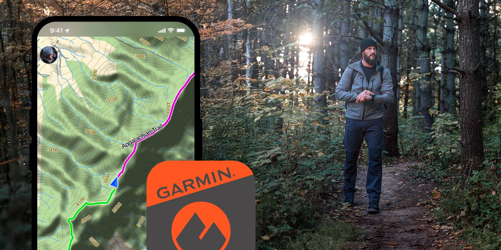
Garmin Explore™ App for off-grid navigation and more

Communicate globally with inReach® satellite technology
| AUTOMATIC ROUTING (TURN BY TURN ROUTING ON ROADS) FOR MOTORIZED VEHICLES |  |
|---|---|
| PHYSICAL DIMENSIONS | 3.6" x 7.2" x 1.3" (9.19 x 18.30 x 3.27 cm) |
| TOUCHSCREEN | |
| DISPLAY SIZE | 2.55"W x 4.25"H (6.48 x 10.80 cm); 5" diag (12.70 cm) |
| DISPLAY RESOLUTION | 480 x 800 pixels |
| DISPLAY TYPE | WVGA transflective, dual orientation |
| WEIGHT |
14.5 oz (410 g) with included lithium-ion battery pack |
| BATTERY TYPE | rechargeable lithium-ion (included) |
| BATTERY LIFE |
GPS Mode: up to 18 hours |
| WATER RATING | IPX7 |
| MIL-STD-810 | yes (thermal, shock, water, vibe) |
| HIGH-SENSITIVITY RECEIVER | |
| INTERFACE | high speed micro USB and NMEA 0183 compatible |
| MEMORY/HISTORY | 16 GB (user space varies based on included mapping) |


